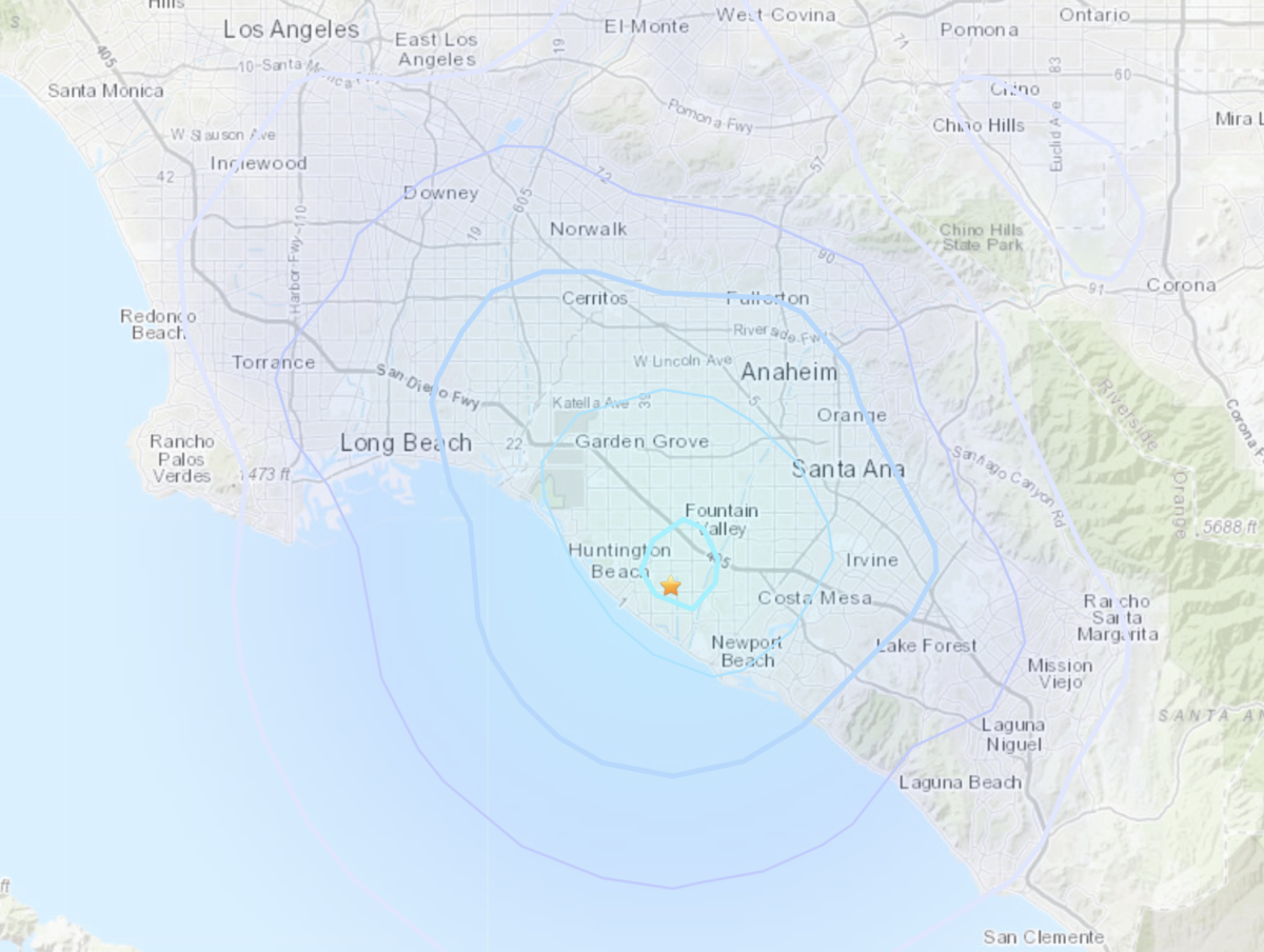
On Friday night, Huntington Beach experienced a magnitude 3.4 earthquake that startled residents and left many wondering about the implications of seismic activity in their area. The tremor struck at 9:52 p.m., with its epicenter located just east of Newland Elementary School. According to the U.S. Geological Survey (USGS), the shaking was classified as light but was strong enough to be felt indoors, reminiscent of a heavy truck colliding with a building.
This earthquake serves as a reminder of the seismic risks present in California, particularly in regions like Huntington Beach, which is situated along the Newport-Inglewood fault zone. As residents felt the ground shake, many took to social media to share their experiences, with one remarking, “That was crazy. ... Our building felt like a semi truck ran into it.” Fortunately, no significant damage was reported by late Friday evening.
Residents in nearby areas, including Newport Beach, Costa Mesa, Fountain Valley, and Garden Grove, also reported light shaking, highlighting the widespread impact of the quake. Understanding the geological factors that contribute to such events can help residents better prepare for future seismic occurrences.

The Newport-Inglewood fault zone, which runs for approximately 46 miles between Culver City and Newport Beach, is known for its potential to produce significant seismic events. The most notable earthquake in this region was the 1933 Long Beach earthquake, which struck with a magnitude of 6.4, resulting in over 120 fatalities. Such historical context emphasizes the importance of earthquake preparedness and awareness among California residents.
Residents are encouraged to report their experiences to the USGS, contributing valuable data to improve understanding of seismic activity. By staying informed and prepared, communities can better respond to earthquakes and enhance their resilience in the face of potential future events.
/arc-anglerfish-tgam-prod-tgam.s3.amazonaws.com/public/HYYSKVGRC5DALCNJPGZRRDHE7A)


